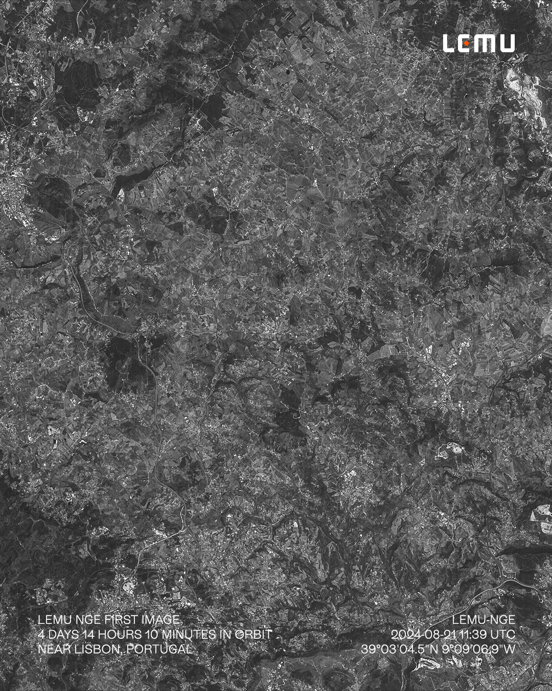
FRUTILLAR, Chile (September 5, 2024) — Lemu announced today that its biodiversity-focused nanosatellite, Lemu Nge (“Forest Eye”), successfully captured its first image on August 21, 2024, just four days after entering orbit. The achievement marks a milestone in hyperspectral Earth observation, as results of this clarity typically take months or even years to achieve.
Key Highlights
- Lemu Nge captured its flawless first image only 4 days, 14 hours, and 10 minutes after launch — far faster than industry standards.
- The inaugural image, taken on August 21, 2024, shows vineyards north of Lisbon, Portugal, with exceptional clarity.
- Lemu Nge will now begin calibrating its 32 hyperspectral bands to monitor ecosystems across Chile and the Global South.
At exactly 11:39 UTC, Lemu Nge recorded 5,000 lines in the Panchromatic band (250–625 nm), producing a 23 x 28 km image of vineyards north of Lisbon, Portugal. The black-and-white capture, colourised with AI to highlight surface distinctions, demonstrates the satellite’s ability to deliver high-quality data even before full calibration.
The nanosatellite — only the size of a shoebox and consuming the equivalent of four LED light bulbs — will eventually capture up to 32 gigapixels in a single pass across 32 hyperspectral bands, covering more than two million hectares of ecosystems. This capacity will enable Lemu to distinguish between vegetation types, water, infrastructure, and other environmental features with unprecedented precision.
“Seeing such a flawless result less than a week after launch is extraordinary,” said Leo Prieto, Founder and CEO of Lemu. “Now begins the crucial testing and calibration phase, configuring the hyperspectral bands and propulsion system to capture the ecosystems of Chile and the Global South. Our mission is to make nature visible in every decision, and this is a giant step forward.”
The successful first capture underscores the collective intelligence of the global team behind Lemu Nge. As Prieto noted, “Nobody ever achieves anything alone — this milestone belongs to every person who contributed to this mission.”
More images are already being tested, including the first RGB capture, with further updates expected soon.
About Lemu
Lemu is Latin America’s leading Nature Tech company, making nature visible in every decision. We launched Lemu Nge, the world’s first biodiversity-focused hyperspectral satellite, and Atlas, our Nature Intelligence platform that transforms complex environmental data into clear, actionable insight. By combining AI, satellite data, and ecological science, Lemu brings Nature Intelligence to Business Intelligence — helping companies, governments, and communities understand their impact and dependence on nature, and protect the living systems we all rely on.

