GBF
The Kunming–Montreal Global Biodiversity Framework (GBF) is the landmark international agreement adopted in 2022 to guide global action to halt and reverse biodiversity loss by 2030.
· Lemu
UNCEEA
United Nations Committee of Experts on Environmental-Economic Accounting (UNCEEA) develops and promotes the System of Environmental-Economic Accounting (SEEA) as the global standard for integrating nature into economic statistics.
· Lemu
NCAA
The Natural Capital Accounting and Valuation of Ecosystem Services project (NCAA) is a joint initiative supporting countries in integrating ecosystem and biodiversity values into national economic planning and reporting.
· Lemu
SEEA
The System of Environmental-Economic Accounting (SEEA) is the global statistical standard for integrating nature and the economy into a single accounting framework, linking ecosystems and natural capital to economic activity.
· Lemu
TNFD
A global framework helping companies and financial institutions disclose and act on nature-related risks and opportunities, shifting finance towards nature-positive outcomes.
· Lemu
TCFD
A global framework that guides companies and investors to disclose climate-related financial risks and opportunities, shaping how markets integrate climate into decision-making.
· Lemu
SBTN
The Science Based Targets Network guides companies and cities to set measurable, science-based targets across biodiversity, water, land, and oceans — extending beyond carbon.
· Lemu
CBD
The Convention on Biological Diversity (CBD) is a landmark international treaty adopted in 1992 that provides a comprehensive framework for the conservation of biodiversity, sustainable use of its components, and fair sharing of benefits from genetic resources.
· Lemu
Let’s talk about Lemu Nge
· Lemu
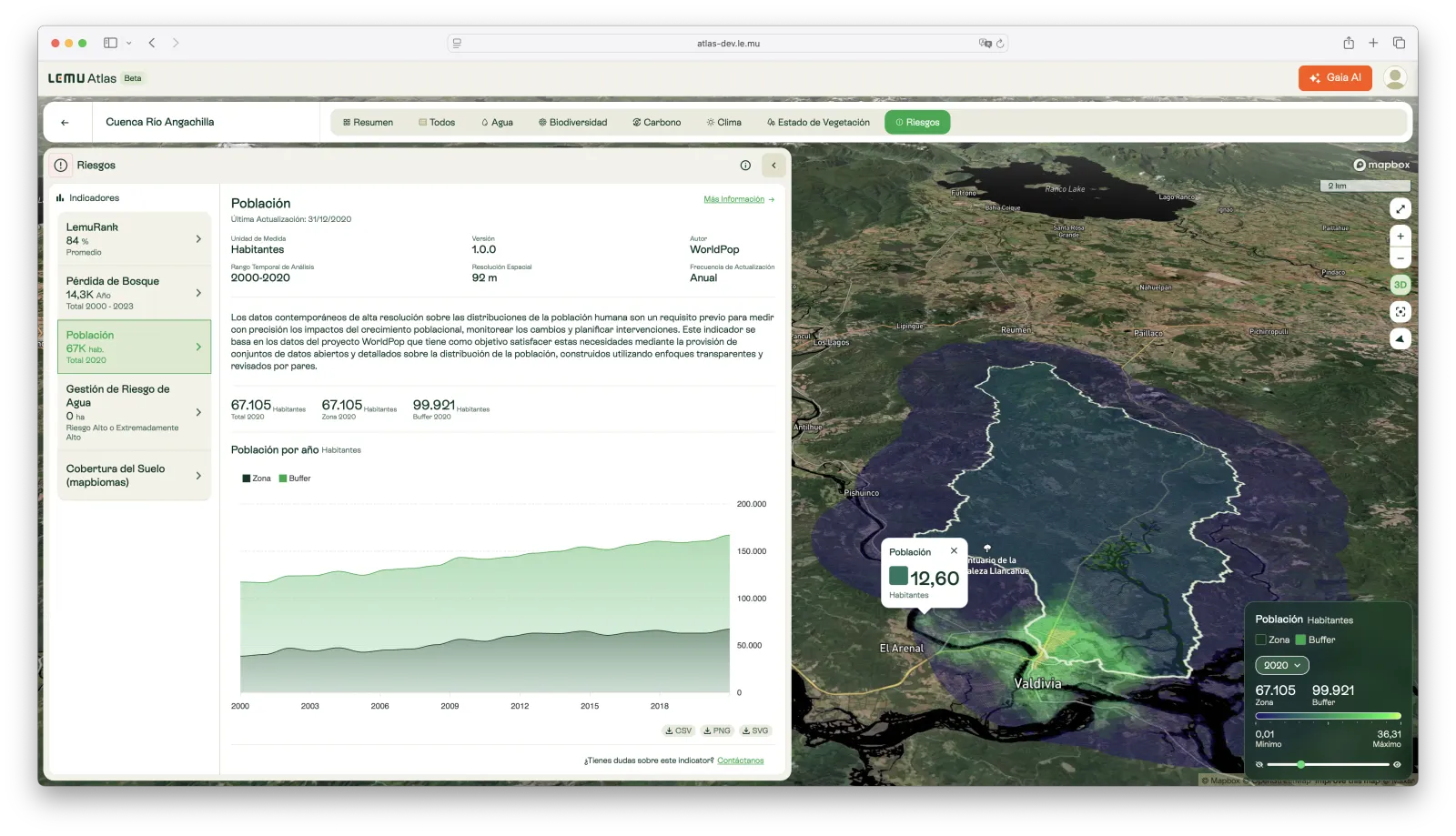
Population
High-resolution gridded estimates of human population distribution, derived from census data and ancillary variables, available annually since 2000.
· Lemu
NASA
NASA is the United States government agency responsible for civilian space exploration, aeronautics, and Earth science. Its open data satellites and missions form the backbone of climate and biodiversity monitoring worldwide.
· Lemu
NDVI Trend (Greenpulse)
Long-term trends in vegetation greenness (NDVI) from 2001–2023, detecting whether ecosystems are improving, stable, or degrading.
· Lemu
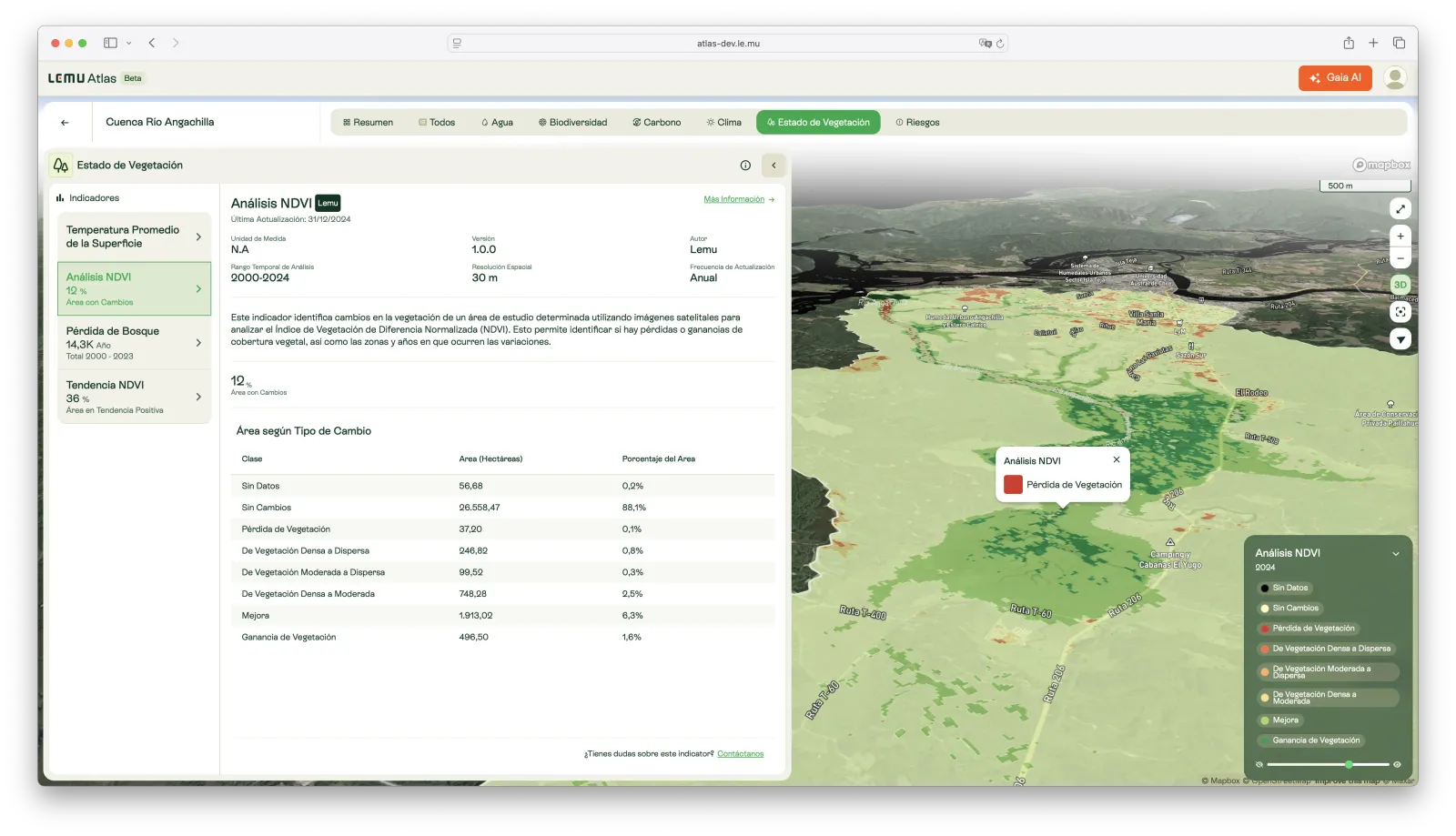
NDVI Analysis
Detection of vegetation cover changes using the Normalized Difference Vegetation Index (NDVI), identifying areas of gain, loss, or stability since 2000.
· Lemu
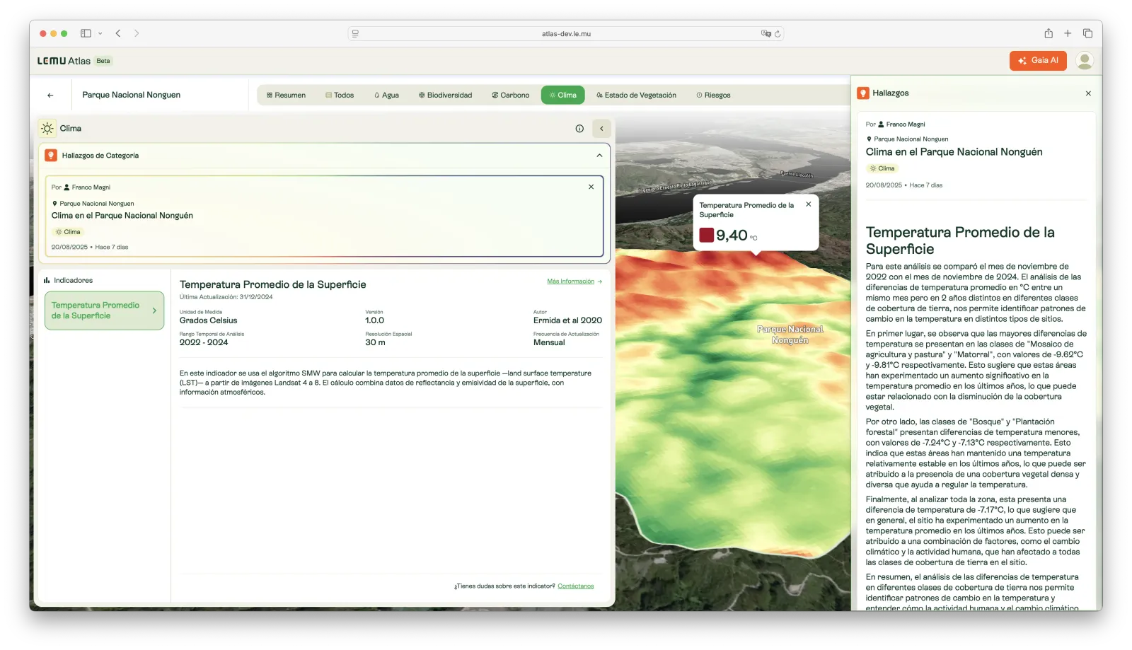
Mean Land Surface Temperature (LST)
Monthly land surface temperature estimates (°C) from Landsat 4–8, integrating surface reflectance, emissivity, and atmospheric data for high-resolution monitoring.
· Lemu
Biomass Carbon Trend (CarbonFlux)
Analysis of long-term trends (2001–2022) in total biomass carbon, identifying whether ecosystems are gaining, losing, or maintaining carbon stocks.
· Lemu
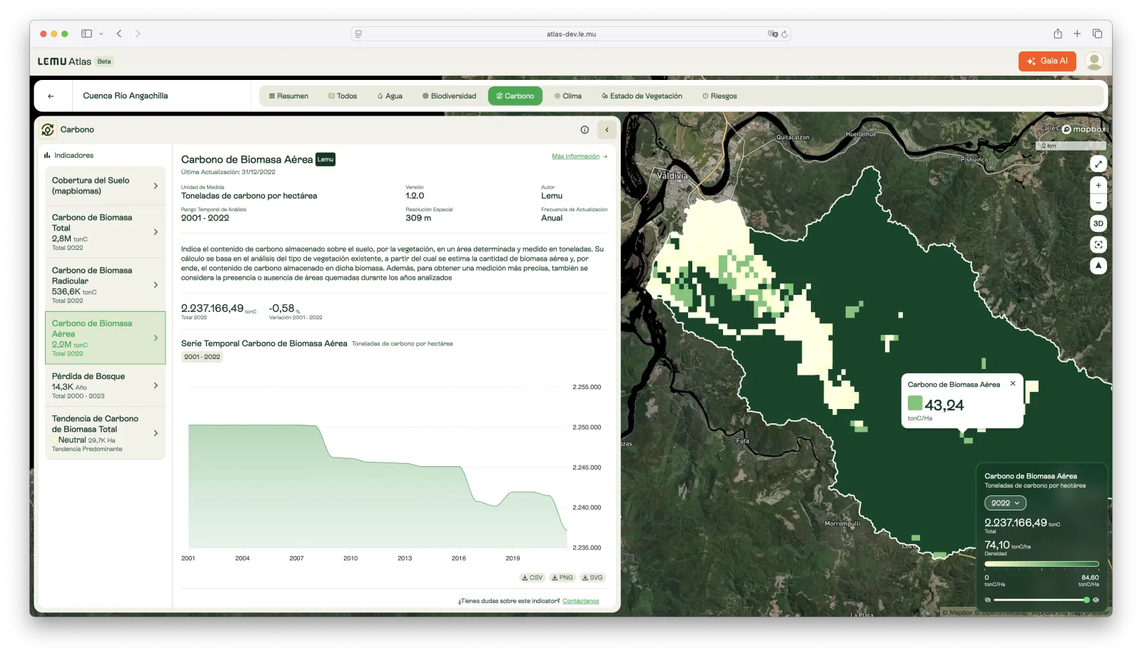
Above-ground Biomass Carbon
Annual estimates of carbon stored in vegetation above the soil surface, monitoring ecosystem carbon dynamics since 2001.
· Lemu
Below-ground Biomass Carbon
Annual estimates of carbon stored in plant root systems, providing insight into below-ground contributions to ecosystem carbon stocks since 2001.
· Lemu
Total Biomass Carbon
Annual estimates of total biomass carbon stocks (above- and below-ground) per hectare, enabling monitoring of ecosystem carbon balance since 2001.
· Lemu
Land Cover (MapBiomas)
Annual land cover classification from MapBiomas, derived from satellite imagery and machine learning, tracking changes in landscapes since 2000.
· Lemu
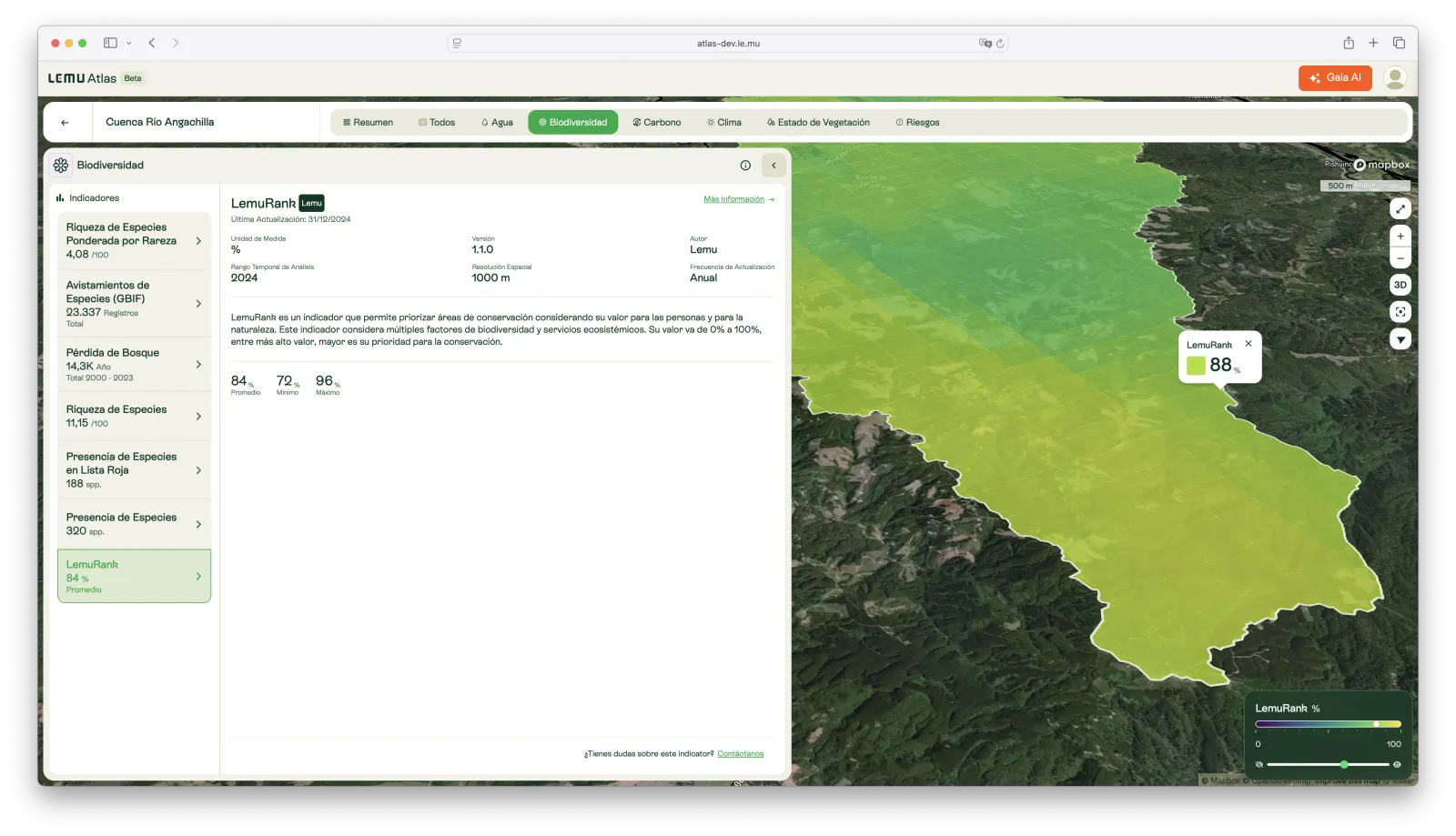
LemuRank
A global conservation priority index (0–100%) that highlights areas with the highest ecological value and need for preservation.
· Lemu
Species Presence
Lists species with a high probability of occurring in the selected area, based on GBIF records and environmental suitability models.
· Lemu
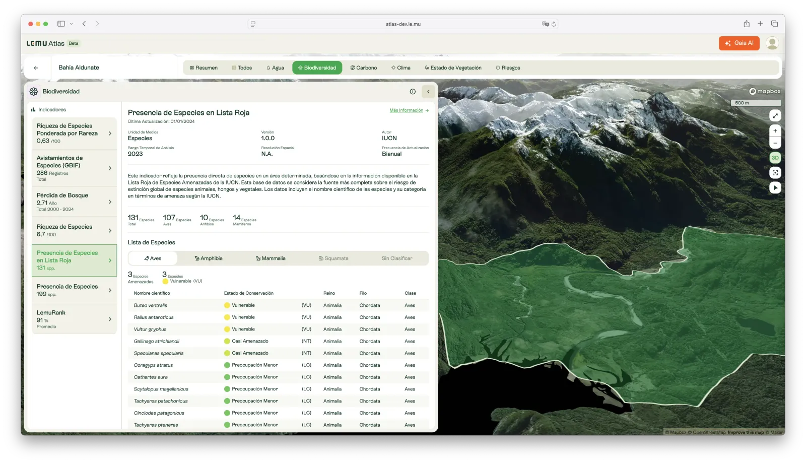
Red List Species Presence
Direct presence of species in a given area, classified by extinction risk categories from the IUCN Red List of Threatened Species.
· Lemu
Species Richness
An estimate of species richness at global scale, combining GBIF records with environmental layers to identify biodiversity hotspots.
· Lemu
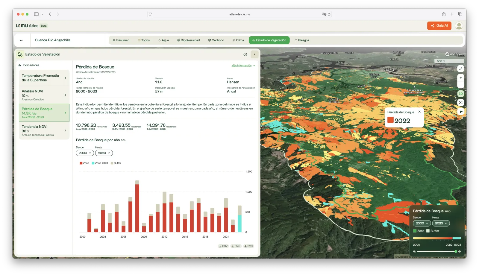
Forest Loss
Annual forest cover loss detected from satellite imagery, identifying where and when canopy disturbances have occurred since 2000.
· Lemu
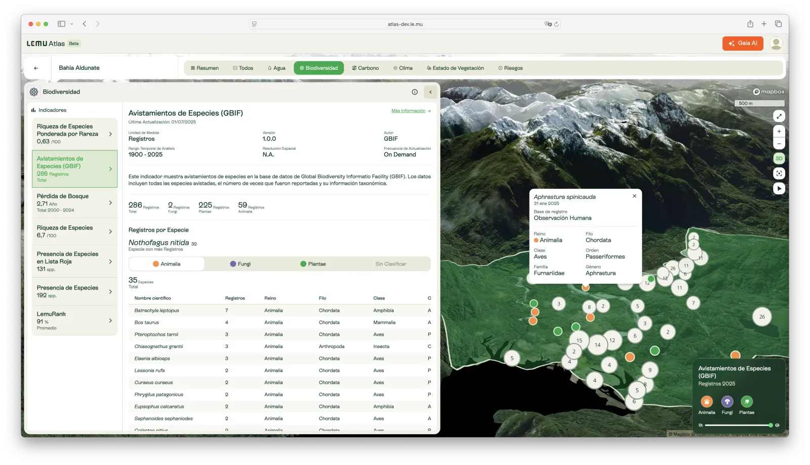
Species Sightings (GBIF)
Records of species observations from the GBIF database, including reported occurrences, number of sightings, and taxonomic information.
· Lemu
Rarity-weighted Species Richness (Biorarity)
An index of species richness adjusted by rarity, highlighting areas with unique and geographically restricted species distributions.
· Lemu
Water Risk
A composite index of water-related risk, covering scarcity, quality, and regulatory pressures, developed by WRI’s Aqueduct platform.
· Lemu

Atlas Indicators
Explore 17 science-based indicators that make nature visible. From water and carbon to biodiversity and climate, Atlas translates complex environmental data into clear, actionable insight.
· Lemu
SASB
The Sustainability Accounting Standards Board (SASB) developed industry-specific standards to help businesses disclose financially material sustainability information to investors. In 2021, SASB merged into the Value Reporting Foundation, which later consolidated into the IFRS Foundation.
· Lemu
