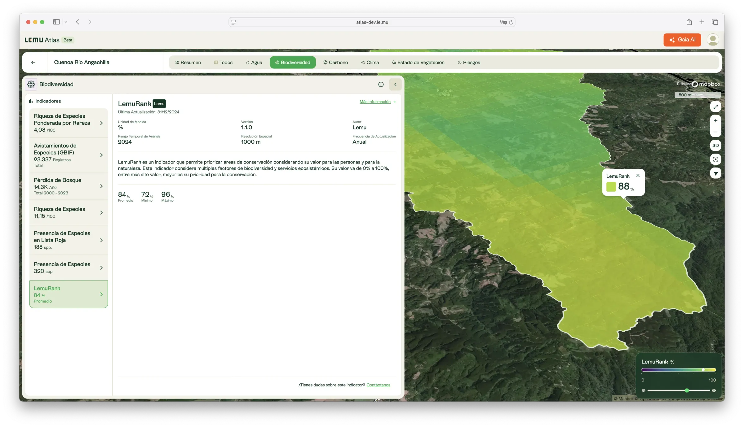
LemuRank
A global conservation priority index (0–100%) that highlights areas with the highest ecological value and need for preservation.

Description
LemuRank is an easy-to-use index that identifies and prioritises key areas for conservation worldwide. It applies a Spatial Conservation Prioritisation approach at global and regional scales, using 1 km² grid cells as the unit of analysis.
The index integrates multiple factors related to biodiversity and ecosystem services. Values range from 0% to 100%, with higher values corresponding to areas of greater conservation importance. These are zones where preservation is most critical to ensure long-term ecological sustainability.
What it measures
- Conservation priority at global and regional scale.
- Integration of biodiversity, ecosystem services, and human pressures.
- Relative value of each grid cell (0–100%).
How to interpret
- Low values (near 0%): Lower relative conservation need.
- High values (closer to 100%): Highest priority areas for biodiversity and ecosystem service preservation.
Unit / Scale
Percentage (0–100%).
Spatial resolution: 1000 m.
Temporal coverage: 2024.
Update frequency: Annual.
Author / Source
Lemu — integrating data from multiple global biodiversity, climate, and land-use datasets.
Key sources include (but not limited to):
- Copernicus Climate Change Service (C3S) — Land cover classification
- IUCN Red List (2023)
- GBIF occurrence data (2023)
- WDPA: World Database on Protected Areas (UNEP-WCMC, 2023)
- EDGE of Existence (Zoological Society of London, 2023)
- IPCC Tier-1 Global Biomass Carbon Map
- MODIS vegetation indices and burned area datasets
- Global Human Modification of Terrestrial Systems (SEDAC, 2020)
- Dynamic World (Google/WRI, 2022)
🔗 https://www.iucnredlist.org
🔗 https://www.gbif.org
🔗 https://www.unep-wcmc.org
Applications in Atlas
- Prioritise conservation areas at multiple scales.
- Identify critical ecosystems for biodiversity and ecosystem service provision.
- Guide sustainable planning, restoration, and policy interventions.
- Support reporting and alignment with global biodiversity frameworks (e.g. GBF, TNFD).