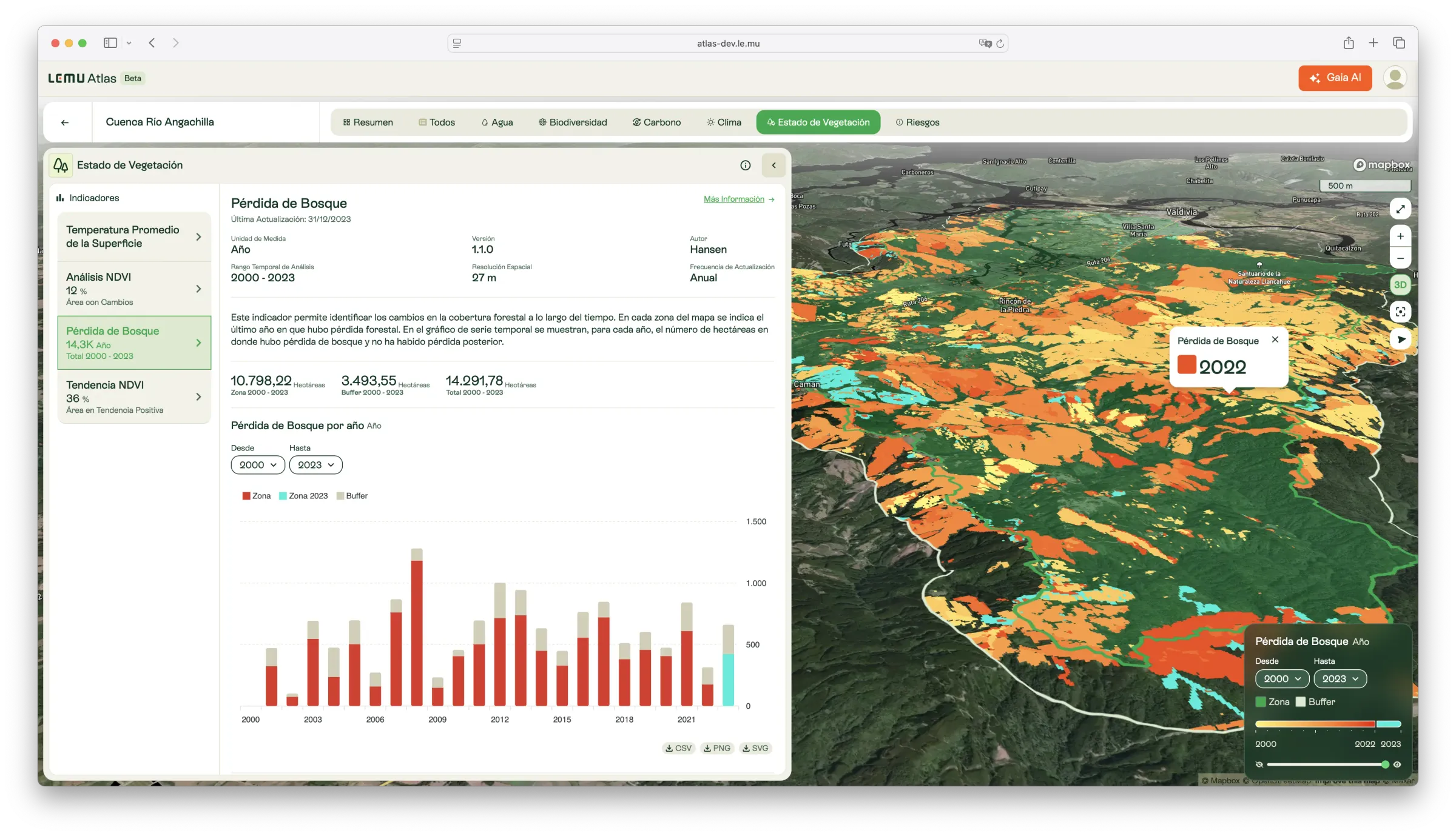
Forest Loss
Annual forest cover loss detected from satellite imagery, identifying where and when canopy disturbances have occurred since 2000.

Description
This indicator identifies forest cover loss over time, defined as a disturbance that replaces or completely removes the forest canopy. Detection is based on Landsat imagery at 30 m resolution, as part of the Global Forest Change project led by Hansen and collaborators.
The indicator reports the most recent year of forest loss per pixel, as well as the annual number of hectares lost where no subsequent regrowth has been detected. This enables consistent monitoring of forest disturbance across all regions of the world.
What it measures
- Annual forest cover loss (2000–2023).
- Total area affected, expressed in hectares.
- The most recent year in which loss was detected per location.
How to interpret
- Values reflect canopy cover removal rather than temporary changes such as seasonal leaf loss.
- Higher annual values indicate significant disturbance, which may result from deforestation, logging, fire, pests, or storms.
Unit / Scale
Year (per pixel), with annual aggregated area in hectares.
Spatial resolution: 27–30 m.
Author / Source
Hansen et al. — Global Forest Change dataset.
🔗 https://earthenginepartners.appspot.com/science-2013-global-forest
📄 Hansen, M. C., Potapov, P. V., Moore, R., Hancher, M., Turubanova, S. A., Tyukavina, A., … & Townshend, J. R. G. (2013). High-resolution global maps of 21st-century forest cover change. Science, 342(6160), 850–853.
Applications in Atlas
- Detect and quantify forest loss in conservation areas and project sites.
- Support monitoring of deforestation drivers and land-use change.
- Provide inputs for carbon accounting, biodiversity impact studies, and policy assessments.